|
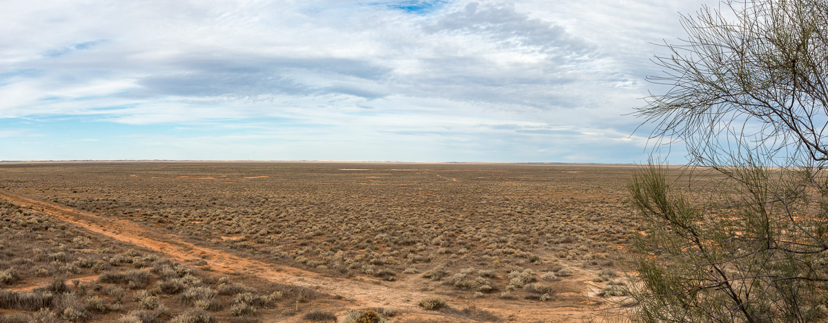
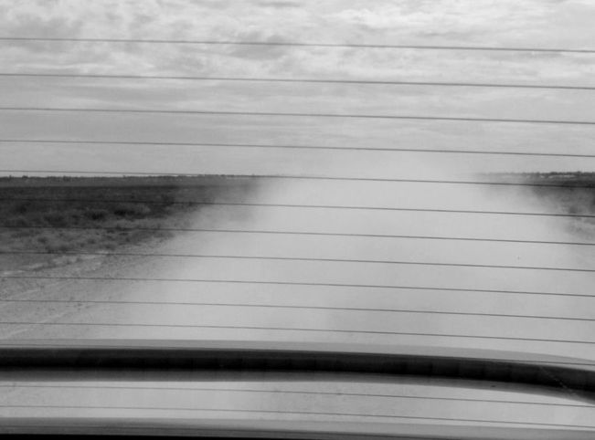
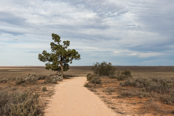
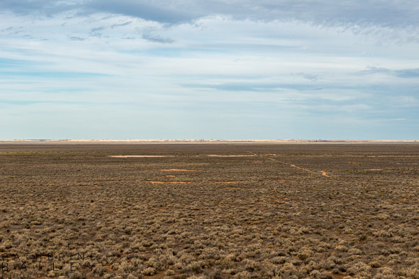
Wanna learn something about history and be the envy of your friends at your next pool party? Get a cuppa then. Lake Mungo is a lake bed that dried up about 15,000 years ago. Aboriginal people inhabited this area at least 50,000 years ago and it’s where Mungo Lady and Mungo Man were discovered (in 1968 and 1974 respectively). It's one of the oldest places outside of Africa to have been occupied by human beings, and Aboriginal people believe that before the Dreaming, there was a ‘land before time’ that was flat and lifeless. A bit like this: It’s in New South Wales, about an hour and a bit’s drive north of Mildura if you don’t use Google Maps. Imagine my surprise when Google wanted to take me on a 4 hour drive to get there from Mildura. I mean, I know there’s dirt roads and you have to be somewhat careful, but suggesting I go 50km out of my way or that I drive at 20kph? WTF Google?? In fact, I just had a look at the directions on Whereis for the hell of it – and it gave me a 13 hour, 45 minute estimate to go from Mildura Central to Lake Mungo campground. Of course, this route goes via Renmark on the Murray River, down to the Barossa Valley (I could pick up some nice wines), up to Burra (did you know these places are all in South Australia?) before heading up to Broken Hill (in the right state at least), then down to Lake Mungo. Only 1,220kms! Imagine all the crisps I'd get through on that road trip. Because I already had some pre-road trip knowledge of Mungo, I was confident it wasn’t really 4 hours away. But what if it was? What if my informant was wrong? The best course of action in this situation is to ask someone in the know. Someone local. Someone who doesn’t want to be questioned about your disappearance, so they’re unlikely to send you to the wrong state. So, having been visited by a sensible idea, I went into the Tourist Info Centre and had a chat with a lovely staff member who rolled her eyes, did that ‘tch’ sound people do when they’re a little bit annoyed, and said “Google’s useless! We think it’s confused because we use dirt roads a lot up here. Just ignore it and use this paper map instead.” As she handed over the map, she provided this golden nugget of information: “The drive’s about 120km, mostly dirt or gravel; you can do 100kph in some places but most people are comfortable at 80kph. You should get there in an hour and a half–ish.” Challenge accepted! Flashie drove from Mildura to the end of the bitumen. The next 100 kilometres were mine to fang through (yes, of course I kept to the speed limit officer) and I have to say, it was bloody great fun! The road alternates between gravel, red dirt, sand, white clay, bitumen-bordered cattle grids and corrugation, so it’s a challenging drive - especially when a car approaches from the opposite direction. A small act of faith is required to drive through the oncoming dust wake - I just closed my eyes* and hoped not to hit a cow. Imagine the damage to my car and karma! I'm sure the cow would've been alright. It takes a B-double road train to explode one of those buggers. Having spent 3 or so hours getting there, we only had about 3 hours to look around before sundown as I didn't fancy tackling the Arumpo Rd back to the bitumen in the dark. We started with a look around the visitor centre, paid our 'day use' fee ($8) and then Flash took over the driving while I gaped out the window. Our first stop was at the Walls of China – a long lunette of elevations formed over thousands of years, which rise up to 30 metres in places. The Walls are made up of four layers of sand and silt, creating various sized dunes etched by wind and rain erosion and ranging in colour from grey and brown through to pink and white. Sandhill wattle bushes are dotted here and there, but good shade is the domain of the Rosewood trees which are few and far between in the immediate area. The day was hot and humid so we opted for a short stroll along the boardwalks that provide a lookout over the area. Access to the dunes is by guided walking tour only ($50 for a 2 hour jaunt) but the boardwalks give a good overview of the land. When the wind blows, the sands skittle along to add to the lunette, whilst torrential rains cut river channels across the terrain. Back in the car, we cranked the air con and continued on to Red Top Lookout, where the two way driving system ends and decisions must be made. The first decision is to get out for a closer look at the lunette, for we’re now further south but on top of the Wall and the view is quite different. Mungo is part of the Willandra Lakes World Heritage Site and was once under sea. After the sea retracted about 5 million years ago, the area became stable – no earthquakes, volcanos, or glaciers were active for several million years. The Willandra Creek brought clay and sand to the lakes and dumped sediment in the lake basins. Westerly winds collected the sediments and deposited them in such a way that a crescent shape of dunes (the lunette) was formed around Lake Mungo. The lunette grew and people lived here at least 45,000 years ago when the lake was full and times were abundant. But when a glacial phase peaked about 20,000 years ago, the lakes started to dry out and human activity faded. When the climate steadied about 15,000 years ago, the lake beds were dry and have remained that way ever since. The lunette began to wear away due to wind and rain, and the arrival of European settlers hastened erosion as their stock ate or trampled what little vegetation was left. Scientists started coming to Mungo about 40 years ago after the discovery of Mungo Lady (the oldest human remains found in Australia), and have continued to study the land and the artefacts that are uncovered as the landscape changes. It's estimated that the lunette moves about 3 metres every year due to wind. The second decision is whether or not we do the entire circuit of the park, which is about 70km. Although there are loads of interesting things to see, time is against us so we opt to stick to the shorter circuit and return to Mungo Woolshed near the visitor centre. The woolshed was constructed on Gol Gol station, one of the first stock stations in the area, in 1869. It was built of termite resistant white cypress pine by Chinese labourers who had come to the area searching for gold. It was much bigger than it is now – part of it was dismantled and rebuilt about 3km away at Zanci station in 1922. Gol Gol shearers worked across 30 stands in the original shed, and could de-fleece up to 50,000 sheep in a season. That's a physio's dream clientele, right there. Last but not least, a stop at Mungo Lookout for views over the lake floor. Given the sheer size of this area, it's not hard to imagine mega fauna roaming around. This Ice Age lake bed has already revealed long buried bones of various ancient animals; it's just a matter of time before it gives up some more. We hit the dirty Arumpo Road and drove past heaps of cows, goats and llamas (whereupon I was suddenly possessed of a need to shout "Lookout, there are llamas!" in a strange, Spanglish voice) and made it back to Mildura just as the sky turned pink and the sun started its final journey to the horizon. So there you go - lots of information about Lake Mungo that you can claim as your own next time you're stuck for conversation at a party. I'm so good to you! *Of course I didn't really close my eyes. Well, not all the way...
1 Comment
Theresa Tom
18/6/2018 19:58:22
Once again ...why aren't you famous ? Would never have known all that stuff...and thank god you explained what a bloody lunette is ....see you are edumacating us plebs ....no ,we don't want your petrol and chips bill xxx
Reply
Leave a Reply. |
Archives
July 2019
Categories
All
|


 RSS Feed
